
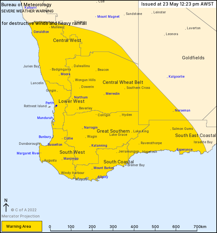
Source: Bureau of Meteorology
For people in Central West, Lower West, South West, South Coastal,
South East Coastal, Great Southern, Central Wheat Belt and parts of
Gascoyne and Goldfields districts.
Issued at 12:23 pm Monday, 23 May 2022.
DAMAGING, LOCALLY DESTRUCTIVE WINDS AND HEAVY RAINFALL FORECAST
FOR PARTS OF SOUTHWEST WA.
Weather Situation: A deep low pressure system about 984 hPa
southwest of WA is moving northeastwards and is forecast to be near
the South West coast around midnight. The low is then expected to
move eastwards parallel to the southern WA coast during Tuesday
morning, then weaken and move southeastwards during Tuesday
afternoon.
Widespread DAMAGING WINDS, averaging 60 to 70 km/h with peak gusts
to around 100 km/h are likely for the Central West, Lower West and
South West districts, with more isolated damaging winds extending
further inland across the warning area later today.
Locally DESTRUCTIVE WIND GUSTS in excess of 125 km/h are also
possible associated with thunderstorm activity.
Locations which may be affected include Albany, Bunbury,
Busselton, Geraldton, Katanning, Mandurah, Manjimup, Margaret
River, Merredin, Moora, Narrogin, Northam, Norseman, Mount Barker,
Perth and Esperance.
HEAVY RAINFALL which may lead to FLASH FLOODING is possible for
locations south of Jurien Bay, extending from the coast to the
Darling Scarp through this afternoon. Six-hourly rainfall totals
between 50 to 60 mm are possible. Locations which may be affected
include Jurien Bay, Perth, Mandurah, Bunbury, Busselton and
Margaret River.
Slippery roads and gusty winds will make driving conditions
dangerous.
This system is expected to be windier than a typical cold front,
and is likely to produce the kind of weather that is only seen
around twice per year.
Mandurah recorded a wind gust of 104 km/h at 9:34 am
Chapman Valley near Geraldton recorded a wind gust of 89 km/h at
11:07 am
Ocean Reef recorded a wind gust of 89 km/h at 11:53 am
Rottnest Island recorded a wind gust of 93 km/h at 7.31 am
Mandurah recorded 22 mm in 30 minutes to 9:42 am.
The Department of Fire and Emergency Services advises that people
should:
* If outside find safe shelter away from trees, power lines, storm
water drains and streams.
* Close your curtains and blinds, and stay inside away from
windows.
* Unplug electrical appliances and do not use land line telephones
if there is lightning.
* If boating, swimming or surfing leave the water.
* Be alert and watch for hazards on the road such as fallen power
lines and loose debris.
* Keep away from flooded drains, rivers, streams and
waterways.
* Be careful of fallen trees, damaged buildings and debris.
* Be careful of fallen power lines. They are dangerous and should
always be treated as live.
* Assess your home, car and property for damage.
* If damage has occurred take photos and contact your insurance
company to organise permanent repairs.
* If your home or property has significant damage, like a badly
damaged roof or flooding, call the SES on 132 500.
23/May/2022 04:31 AM

